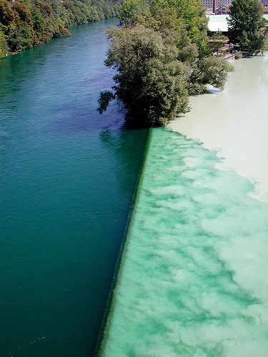
The Rhône and Arve rivers join just east of downtown Geneva. Before the Rhône's green water swirls in completely with the Arve's brown, the two rivers seem to resist each other, almost forming a line -- green on one side, murky tan on the other (after looking at lots of pictures, I think there's actually a low wall that intensifies the effect).
The first time I saw the confluence, I was on the bridge that spans the rivers just above the junction. I had a perfect view of the rivers meeting and the V of land that ends their separation. The colors stopped me that day, and when I returned to Geneva last month with my husband, I wanted to show him this spot.
I'm good with directions and can usually find my way back to places I've been once without too much help from Google. So I led my husband down the banks of the Rhône, reassured by signs warning us against swimming (the icy Arve waters were just around the corner!).
I got us to the confluence, but if you ever go yourself, make sure you're on the right side of the river. A quick Google map check would have reminded me to walk down the north bank of the Rhône, where you can access the bridge that provides this lovely view:
The south bank takes you to that peninsula, where you get the stench of the Arve and this view:

